Implementation
This GeoPad system was first implemented in UCR's 2016 four-week GEO 102A-B Summer Field Geology course, which was the final course many of the eleven undergraduate students took before graduating. The course is designed to be a capstone culmination of their degree, with prerequisite courses including Petrology, Sedimentology, Structural Geology, and two field mapping courses (which themselves have prerequisites). While traditional field mapping methods played a strong role in the Summer Field Geology course, we involved use of the tablets in about half of the field projects. The field projects were variable in scope and goals, and lasted one to eight days each.
We issued a complete kit to each student about a month before leaving for summer field, explaining the basic concept and going over some of the setup in a one-hour meeting. This was then followed by a half-day field excursion to give the students the opportunity to create a simplified geologic map (we chose to keep this an ungraded exercise). One of the first exercises we did was to go to a large, dipping bedding plane, have each person in the class take a strike-and-dip of bedding using their Brunton compasses (which I recorded in my field notebook), and then had each person in the class take the same measurement using their iPad (again I recorded). This was a good confidence boosting exercise for both the instructor and class, as a shotgun-blast of compass-collected data (attributed to student measuring error not the compass directly) shrunk to a +/- 2 degree iPad-collected data cluster.

|

|
We reissued the iPad kits to the students about 1.5 weeks into the Summer Field course, after they completed a large traditional mapping project (Eastern California's classic Poleta Folds). The focus of this project was mapping the bedrock geology in a structural and stratigraphically challenging setting with very well-exposed outcrop. The first digital exercise assigned to the students was a 0.5 mi x 1.5 mi region immediately south of the area they had just mapped.
The students had a half day to interpret the geology remotely from the field classroom (drawing faults, folds and unit contacts from aerial and lidar imagery), one full day in the field to map as much as they could, and then an evening to refine their map before submission. By having their first digital project in a geological environment they were well acquainted with (climate, terrain, geology), the students could focus on learning to use the iPads effectively. This was a unique and effective exercise in several ways: (1) the students learned they could efficiently map the geology of an area remotely from high quality imagery if they were equipped with local experience and background knowledge of what they could expect to find, (2) the students were exposed to the real world scenario of not having as much time on a project as you would ideally like, and (3) the students could form a more direct comparison of the advantages and disadvantages of traditional field mapping methods compared to current digital mapping methods since they were mapping a new region but with familiar stratigraphy and structures (they found that they could take more measurements and cover more ground in less time, but found screen glare and glitches to be new challenges).
Although three or more field days could have easily been spent mapping this region, both I and the students were impressed with what they were able to map in 1.5 days. Student feedback suggested this project served as an effective bridge into the digital field mapping world.

|

|
-
A 2-day project focusing on mapping metamorphic rocks and their relationships to a pluton in an alpine setting (Crooked Creek, White Mountains, CA)
-
A 1-day project focusing on mapping glacial geomorphic features of multiple ages (Convict Lake, Long Valley, CA).
-
A 2-day project focusing on mapping multiply-deformed metamorphic roof pendant rocks and their relationships to intrusive rocks in a forested setting (Gull Lake, Eastern Sierras, CA).
-
A 2-day project focusing on mapping volcanic lithofacies, vent locations, and former lake shores on an emergent subaqueous-subaerial Surtseyan volcanic edifice (Black Point, Mono Lake, CA).
-
A 1-day project focusing on analyzing rock slope stability of blasted roadcuts along a gated access road (Owens River Gorge, CA). The iPads were used to efficiently take structural measurements but not really for mapping.

|

|

|

|
For simplicity we had the Summer Field students make all their finishing touches within FieldMove (or Google Earth if they preferred), then export their project as a KMZ, which was shared to a Google Drive folder by the deadline. I then created a folder in Google Earth on my PC, which allowed me to easily order the student projects from best to worst. By layering several at a time it was very easy to check for cheating.
Assessment
To assess the student projects I used a rubric I created with the above workflow in mind (adapted for all editing to be done on the GeoPad and quick export to a .kmz file). Note that many things relevant to paper or digitally drafted maps are not relevant to digital projects submitted in .kmz format (North arrow, declination, scale, title, etc.). "Neatness" and "accuracy" need to be considered based on a desired map scale. The ability to readily layer multiple student maps in Google Earth provides a very fair means of directly assessing the relative quality of student maps. Potential biases driven by handwriting style or coloring quality are also eliminated.
The digital field mapping project rubric is available for download here

This rubric is modified after one used by Miami University for their capstone field course and publicly available on SERC's website:
serc.carleton.edu/NAGTWorkshops/departments/degree_programs/instruments/miami_capstone_rubric.html
Cheating
Instinct might tell you that a subset of students will latch on to the opportunity to download data and claim it as their own. This concern may be genuine if you are mapping in an area used by other schools. However, if you chose to map in an area effectively only used by your class, you can easily maintain a KMZ database of all past years' student projects. Because you can readily layer as many maps as you want in Google Earth (and check for repeated or copied elements), you can check for cheating more quantitatively and with less effort compared to paper maps. This took only a few minutes for me to check an entire class for potential cheating.
Other Ideas
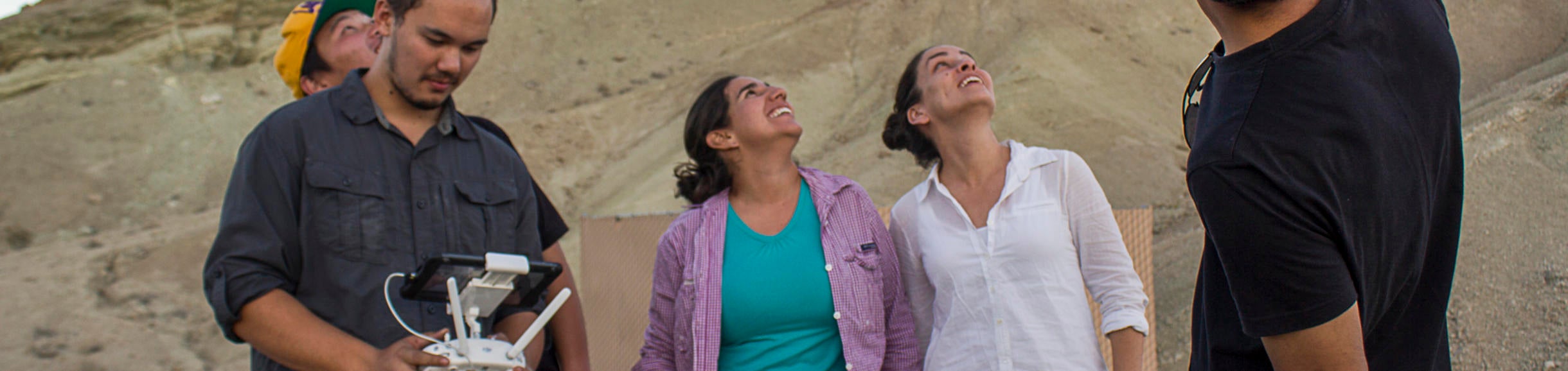
The field mapping exercise could be taken further (and expanded in duration) by teaching students how to use UAV (a.k.a. drone) photographs and structure from motion (SfM) photogrammetry techniques to create their own basemaps (high-resolution orthophotographs, hillshades, and contours). The exact details are beyond the scope of this website but essentially this would require (1) one (or more) field sessions to collect the photos and GPS control points, (2) a lab session to process the data in SfM/GIS programs (e.g., AgiSoft PhotoScan, ArcGIS) and export products to the iPads, (3) one (or more) field sessions mapping on the basemaps in FieldMove, and (4) potentially another lab session (or several) to export and manipulate the data. This is a workflow likely to become much more prevalent in industry and research due to the relatively low cost and ease of use. This concept was demonstrated successfully over a two-day field trip in my Fall 2016 graduate-level Modern Field and Visualization Techniques course (to the delightfully unvegetated and wonderfully exposed Rainbow Basin in the Mojave Desert). Exporting orthomosaics as MBTiles in PhotoScan (with or without contours) can easily be uploaded to the GeoPads in the field to allow students to map on it immediately. If you are really organized, willing to submit to the positional accuracy of the UAV's GPS (~3-4 m), and bring a laptop in the field for processing, it is possible to be able to go through this whole workflow with the students in less than an hour! The resolution of the data was considerably better than the ~5 pts/m2 point density in the 2007 EarthScope airborne lidar data collected for the same area. This greatly impressed the students!

|

|

|

|

|

|

|

|