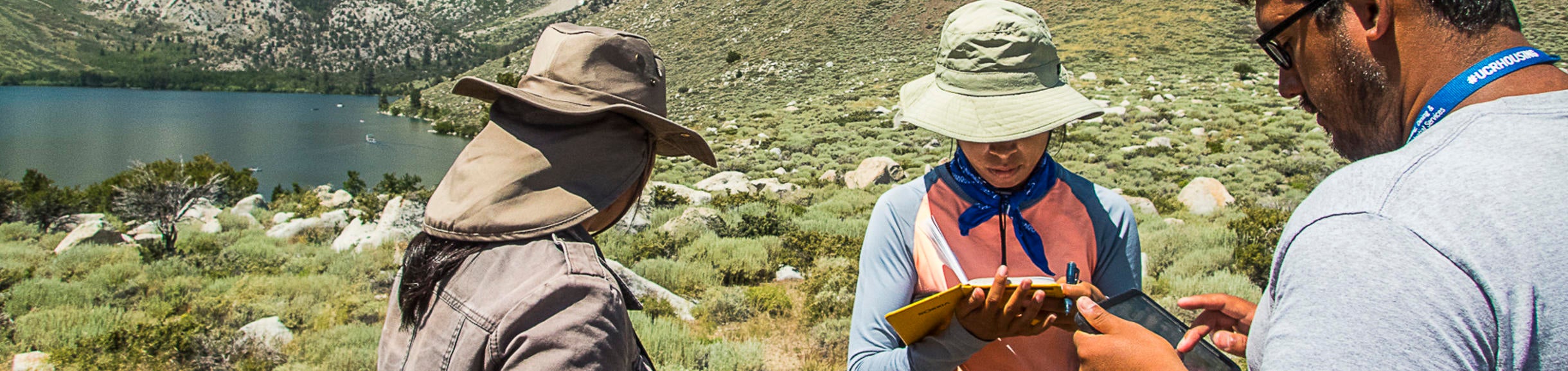
These comments were solicited from 2016 UCR Summer Field Geology students by anonymous web survey at the end of the course (as part of a much longer 40 question survey about the course). This capstone course was the first time these tablets (and digital field mapping) was introduced to the students. The students used the tablets for six 1-2 day mapping activities (in addition to projects utilizing only traditional mapping techniques). Comments are unedited and appear in their entirety. Generally student responses to using this system were quite positive.
-
Overall do you feel like using the iPads in the field enhanced your geological understanding and/or mapping efficiency of an area? Did they contribute to the capstone experience?
-
It definitely increased efficiency. No time was lost finding your location on the map. The ability to simultaneously look at an aerial photo made placing unit boundaries easier.
-
YES! I enjoyed having access to photos and notes in the same place.
-
I have mixed feelings over the iPads. Measurements, mapping, and easy access to multiple maps greatly increases the efficiency of an area. However, glitches in the iPads and my preferred time to hand map my units in a geological paper map also leads me to think "old mapping" is still preferred. I do think using a bit of technology did contribute to the capstone experience.
-
Yes, I enjoyed the iPads tremendously. They were far more convenient to carry around and take measurements with than the traditional map boards and I do think they enhanced the understanding and mapping efficiency of the various areas.
-
There was a moment when everything clicked with the iPads. Before that, I felt like hand mapping was better. After I got the hang of it, I think the ipads proved their worth. They were awesome.
-
Yes, mapping efficiency is increased with regards to taking measurements. Also it allows more time to analyze geological stuff, rather than dealing with bulky map boards, colored pencils and compasses. It is convenient to carry.
-
I do not feel that the iPads enhanced my geological understanding, but they definitely improved my efficiency. The iPads contributed a major role to the capstone experience.
-
I thought they were helpful in that we know where we are. However I paid less attention to where I was because I relied on the GPS. Editing is much easier on the ipad.
-
Yes, mapping was much faster with them.
-
Certainly helped with efficiency but not necessarily with understanding. aerial photographs were the same as the ipad. They did allow for faster mapping which made the work much more possible in the short time so yes they were highly necessary.
-
Yes and yes.
-
-
Do you feel like digital field mapping and data collection were worthwhile skills to learn?
-
Yes
-
Yes, although doing a little more traditional topo mapping would have been nice.
-
Yes, data collection is more efficient in digital field mapping, and for years to come I am confident these will be worthwhile skills to learn.
-
Yes, I think the future of geology will be based on digital data collection (for good or bad) and they are very useful skills to learn.
-
Yes, they are very worthwhile. I imagine that in the future, it will become more of the go-to.
-
Yes, it improves mapping efficiency
-
Yes. Anything that includes newer methods of mapping helps. ie iPad, drones, lidar, etc..
-
Definitely.
-
Yes
-
Most certainly.
-
Yes.
-
-
Given the choice to map an area with a paper map and compass or an iPad, which would you choose?
-
iPad
-
Ipad!
-
If I had to choose one, the iPad. I honestly believe both are still the best tools to learn as experience as much as possible.
-
I would choose an iPad. It as GPS for locating exact positions, is much more convenient to carry, and the paper maps tear and are difficult to correct when mistakes are made (which happens very often).
-
I would choose the iPad.
-
iPad
-
iPad
-
Ipad because it is faster. I don't waste time trying to figure out where I am. But figuring out where you are on the map is a great skill to have.
-
iPad
-
I would choose the Ipad given it's light weight versatile and quick utility and very accurate location notes/photos.
-
iPad without a doubt. Despite all its flaws the iPad is an order of magnitude better than a paper map.
-
-
Should we have used the iPads less often for projects?
-
There were some projects we brought them and they weren't needed on. Gull Lake and the Glacier project we only used the iPads for GPS and note-taking.
-
No, but maybe a mix of the two?
-
I consider it would be better to use less iPad work in the future.
-
No.
-
I preferred the ipads.
-
No, it was the right amount. iPads should only be used for mapping projects
-
No.
-
I think we should use the ipad and paper map equally.
-
No
-
No, I don't think it would have been possible to work as fast.
-
No. We should have taught people how to use them more before field camp.
-
-
What was your favorite feature?
-
Being able to have my photos geotagged was really useful.
-
Pictures, feasibility of adding units, and fast measurement taking.
-
I like the FieldMove app and its GPS feature, enabling me to locate my position in the field and way around it.
-
I liked the overlays you could import. The GPS was very handy. Probably the GPS is the best part--knowing where you are at all times is great.
-
Dip and strike measurements, adding geological units, camera
-
The GPS. I could spend hours trying to figure out where I am on a paper map, but with the iPad I can focus on mapping.
-
The GPS
-
Able to take strikes and dips quickly
-
The gps location of any and all notes and pictures. I could take a photo of the outcrop with annotation and notes, break off a sample, then take a photo of the sample to know which bed it related to, and take the sample back without marking it with names or whatever more difficult methods i've seen.
-
Georeferenced pictures. Amazing. S+D too.
-
-
Is there an app you wished the iPad had?
-
No
-
An app that gave more info on a subject- kind of like a wikipedia app or something. And rock identification for igneous, and metamorphics.
-
Not that I know of.
-
Not that I can think of.
-
I don't think there was anything I felt was missing.
-
A better note-taking app
-
Any app that could help in identifying a rocks.
-
No
-
No, everything needed was already downloaded.
-
Not really.
-
Better map editing software. Something to do cross sections.
-
-
What hardware challenges did you encounter? (stylus tip breaking, screen scratching, overheating, etc, etc.) How frequently? Could these have been prevented or minimized with a "you break it you buy it" motto?
-
Overheating was a big problem for the geotechnical project. I don't think that could be prevented. I may have been more careful to not have the iPad anywhere near me while hammering off a sample with a "break it you buy it" policy.
-
I only encountered a glitch that was fixed with an update. Afterwards, no problems were experienced. People would have definitely been nicer to the iPads if they knew they'd buy it if the break it. But then again, some poeple are just do not know how to take care of anything...
-
Stylus tip breaking, and overheating. After I broke the first Stylus tip in a matter of days, I decided not to use it anymore do it high sensitivity and would not help minimize the "you break it you buy it" motto.
-
I did not encounter any of these problems for the duration of the field camp.
-
Slight scratches on the screen and both stylus tips broke. The ipad kept crashing early on but stopped after week 2 suddenly. The stylus tips are very fragile. I think I took good care of the ipads, but a little more "persuasion" to make sure they come back good doesn't hurt.
-
Stylus tip was easily lost, the Lifeproof screen scratched each time dip and strike measurements were taken. Overheating was rare during the entire field camp.
-
Both of my stylus tips broke. I do not think that a "you break it you buy it" motto could have prevented this because they were so sensitive. I experienced only minimal overheating and scratching, but these are things that are unavoidable. I don't think that a "you break it you buy it" motto could have prevented this.
-
Everything you said above and the GPS turning off randomly. The app crashed on me numerous time. Use the stylus only in the lab not in the field. Definitely you break it you buy it would have made me take care of it more.
-
Stylus tip breaking-once screen scratching- a few times resulting in some scratches overheating-various times, but mostly during the geotechnical project Yes, could be prevented by saying that.
-
Overheating was never a problem if ipad was not held in the sun and kept in hands properly. It literally never overheated for me so it's overheating is entirely user error. GPS problems if held near electronics or metal. that's really it.
-
Stylus tip broke, screen easily scratched, overheated a ton on hot days, short battery life, etc. All these happened a lot. You break you buy it might work but just taking a S+D with the iPads will scratch the case. You can scratch the screen with the stylus even.
-
-
What software challenges did you encounter? (features that did not work well, counter-intuitive user interface, glitches, etc, etc.) These I can report to Midland Valley for improvement.
-
Just the GPS turning off, especially without saying it was off. Sometimes while using fieldmove, it would continuously prompt me to calibrate.
-
Sometimes when I made a new unit I would try to click on it to take a measurement but it recognized it as another unit.
-
The GPS turning off instantly and without warning glitch, that is the most annoying part in the software.
-
The only challenge I encountered was the stylus not registering on the iPad screen because the screen protector was too thick.
-
I would crash to the app selection screen every 5 minutes. That's my only issue. Everything else was manageable.
-
Sometimes the GPS got off-track for a few minutes, dip and strike measurements would sometimes get stuck (the measurement would be frozen in black) and the app would need to be restarted. the GPS tracker should show a line connecting the last known position and the current location, as well as a directional indicator for the blue dot
-
GPS initially takes me to the wrong location. GPS turns off while mapping.
-
The app crashed several times. GPS turns off a lot..
-
FieldMove closing down, some of the maps not downloading correctly especially hillshade, and GPS turning off after battery is below a certain percentage.
-
Does gps count for software or hardware?
- S+D froze, GPS glitches, crashed a lot, random internet linking, constant recalibration.
-

