A Field Geologist's Perspective

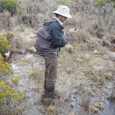
I come from a mapboard and Brunton upbringing, learning to map in many tried-and-true locales in southern California. Taking a measurement or locating myself on a map was never much of a concern, but I did find frustration in the degree of uncertainty inherent in locating from 40 foot contours and that I could not instantly switch between a topo map and an aerial photograph. Carrying out PhD fieldwork in New Zealand's temperate rainforest circa 2009 brought new challenges. With line-of-sight visibility through the bush often limited to about 10 meters, I quickly came to value a Garmin eTrex Legend GPS that I had preloaded with vector topo maps that enabled +/-5m positioning and effective navigation. I learned to put a degree of trust in this technological wonder, but a trusty Silva (my Brunton needle was not weighted for the Southern Hemisphere!) and field notebook still did most of the work. Once back from the field I could compile my GPS locations, notes, and measurements into a spreadsheet and import my data into ArcGIS (not particularly novel for the time). I followed developments to introduce field tablets into geologic mapping with great interest, but for the longest times they seemed to be burdened with greater disadvantages than advantages. They were pricey, heavy, fragile, had limited battery life, poorly visible and low resolution screens, glitchy software with steep learning curves, and they still relied on external GPS and compass requiring considerable manual data entry. With time these barriers were gradually being reduced but not altogether eliminated. The last twenty years of literature contains a patchy record of attempts, updates, and calls to arms to utilize digital mapping both in teaching and in research.

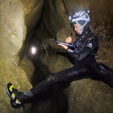
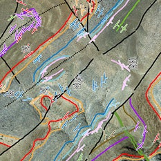
In 2015 I was awarded a UCR grant to explore the current state of field-capable mapping technology and develop a system that could be utilized in our new capstone Summer Field Geology course, and ideally other courses offered by the Department of Earth Sciences. This made price and ease-of-use especially important considerations. Over the last two years I've field tested about a dozen different hardware and software combinations over iOS/Android/Windows platforms. Based on current technology I can confidently say that a ruggedized iPad Mini/FieldMove-based system is the best option I have found. It is the only device that I am aware of that has accurate internal sensors that can both take measurements and locate positions. The advantages far outweigh the downsides and I have used it successfully in my own fieldwork in California, Mexico, and New Zealand over the last year and a half. The technology was successfully implemented in our summer 2016 undergraduate field geology course, and I am finding other courses that could use the tablet system on field trips. It is full steam ahead for us!

Based on the successes of implementing this technology in teaching and research, and the general lack of websites detailing digital field mapping in the geosciences, I was compelled to create this site with the goal of sharing our methods, techniques, and experiences with the hope that it encourages further adoption of digital geologic field mapping in teaching, research, and industry.
I am convinced we are finally here at the cusp of a digital renaissance that will enable a new generation of accurate, data-rich geologic mapping that is more easily shared and used than ever before. I expect some pushback to this technology, but hope that generally people can approach it with an open and willing mind. Yes there are downsides and disadvantages. Yes the technology can and will be improved. How stable and long-lived can a particular system be? Can we get ten years of life out of it? There are also legitimate concerns about increasing the ease of data accessibility in teaching- are we making it easier for students to cheat? In no way do I suggest digital field mapping techniques should completely replace traditional techniques in undergraduate curriculum. I do muse over whether we are now within a long transitional era, at the end of which paper-based field mapping will go the way of the abacus, slide rule, and typewriter, obsolete or specialist technology deserving a brief mention for historical value. Make no mistake, the world is going digital! The tools are now in place to take field geology there.
-nic
Contact
For additions, corrections, questions, or just to let me know that you found the content helpful please contact me at the email address below. If you would like to contribute content I would gladly consider it and acknowledge you appropriately.
Email: nic.barth@ucr.edu
UCR Department of Earth Sciences: https://epsci.ucr.edu/
Nicolas Barth UCR Faculty Profile: https://profiles.ucr.edu/nic.barth
Nicolas Barth Personal Website: http://ncbarth.com/

